


| Re: Crewkerne Gates crossing to be improved Posted by bradshaw at 13:04, 29th December 2025 |     |
I am sure singling had taken place before this photograph was taken. The crossing was our train spotting haunt in the early 60s. We were unofficially allowed in the relief gatekeeper’s hut if the weather was inclement.
From the ORR website
Crewkerne 2024 – Cathole Bridge Road, Crewkerne, Somerset: level crossing order
https://www.orr.gov.uk/media/27696
| Re: Crewkerne Gates crossing to be improved Posted by Witham Bobby at 11:12, 29th December 2025 | |
Report of plans to widen the crossing appear in Somerset Live
https://www.somersetlive.co.uk/news/somerset-news/somerset-level-crossing-could-widened-10720337
this photo shows the manual gates in operation and dates to between May 1967, the singling of the line and November 1967 when the AHB was introduced. The diagram for the 6 lever ground frame is part of my local collection.
A great picture memory and reminder of the damage done by singling. I wonder if the singling had already happened by the date of the photo? Either that, or the D800 is on the rear of a train, or the D800 is at the front of a train running bang road
If I remember well, the redundant track was recovered several months after the operational singling of the line
| Re: Crewkerne Gates crossing to be improved Posted by Chris from Nailsea at 11:06, 29th December 2025 | |
From the BBC:
Plans to widen level crossing for pedestrian link
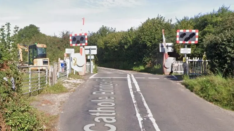
Network Rail want to reroute a public right of way over Cathole Bridge Road level crossing
A level crossing could soon be widened to provide a new pedestrian link after 145 homes were approved nearby.
Network Rail plans to reroute a public right of way over Cathole Bridge Road level crossing near Crewkerne, Somerset. The change would include removing an unsignalised pedestrian route between the level crossing and Crewkerne tunnel, which underwent emergency repairs following a landslip in 2023.
It comes after the Planning Inspectorate granted an appeal by Tilia Homes to construct 145 homes at the nearby Maple Grove site on Lang Road.
According to the Local Democracy Reporting Service, Network Rail applied to Somerset Council for the change in July and are now staging a drop-in event to discuss their rationale on 28 January at the Henhayes Centre.
The crossing provides safe access between Crewkerne and Misterton, with the route running over the London Waterloo to Exeter St. David's line. One train runs each way per hour and is run by newly-nationalised South Western Railway.
The existing right of way runs south of Cathole Bridge Road, near to the Lang Road junction, before crossing the railway line. The route then continues south until it joins a local track, before rejoining Cathole Bridge Road to the east. If Network Rail's diversionary order is approved, the footpath will officially run along Cathole Bridge Road to the end of the track.
Cathole Bridge Road has no pavements, high hedges and regularly serves as a rat run for people seeking to reach Crewkerne railway station without navigating the one-system in the town centre.
Somerset Council has not indicated how soon it could make a ruling on Network Rail's application.
| Crewkerne Gates crossing to be improved Posted by bradshaw at 22:07, 26th December 2025 | |
Report of plans to widen the crossing appear in Somerset Live
https://www.somersetlive.co.uk/news/somerset-news/somerset-level-crossing-could-widened-10720337
this photo shows the manual gates in operation and dates to between May 1967, the singling of the line and November 1967 when the AHB was introduced. The diagram for the 6 lever ground frame is part of my local collection.
